July 30, 2025
We broke camp at Duck Lake today. It took less than two hours to pack everything into the bike—a real puzzle. You have to be deliberate about where everything goes because we’re at capacity on this motorcycle. The gear works well, we can’t complain about that, but there’s just not enough volume.
Both of us are irritable. Poor night’s sleep, waking up multiple times, knowing we had a long day ahead with no certainty about where we’d sleep. Before it’s done—some 300 miles, often traveling with temps in the high 80s and 90s.
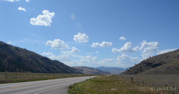
We decided to go around Glacier Park through East Glacier and the town of Browning, avoiding the slow (Going to Sun) and bumpy (Mirror Lake) Routes. Not all is lost though – WY-89 out of St. Mary is stunning—the kind of scenery that makes me long for a solid video camera setup.
Pretty uneventful ride, though I’m fighting sleep and cranky. Tina’s still hacking and sick. She doesn’t complain, but you can tell she’s not feeling well. Traffic is heavy and moving faster than I want to go. We’re headed to West Glacier—stopping for some gear adjustments, but no pictures –> all business today.
When we got into West Glacier, nearly the first billboard you see is for an A&W Root Beer restaurant “Just 3 miles ahead.” That marketing worked on me. I signaled to Tina, she consented. She got a hamburger, I got two chili dogs and onion rings. Not appropriate food for me anymore, but they hark back to old times. I’m going to believe they used something other than cheese whiz back in the late 70s.
Today is problem-solving day, and now we at least have root beer sugar in our stomachs. The central issue: we need to get closer to Lewiston, Idaho, where we pick up a rental car in two days. We don’t want to set up and break camp every 24 hours, so we’re looking for somewhere midway between Duck Lake and Lewiston. That rules out the great riding near Libby and the earlier campsites I’d scoped out on iOverlander.
The other puzzle is laundry—the shirt and socks I’m wearing are on the two-day plan right now. That puzzle gets solved ten minutes up the road in Columbia.
While Tina works the laundry, I pull out paper maps and juggle between OSM Android and the iOverlander app to find candidate sites. There are some good dispersed camping spots near Hot Springs, Montana. That becomes the plan.
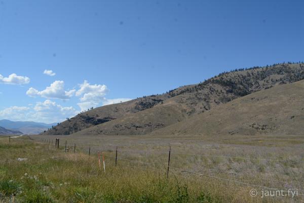
Montana has a huge amount of dispersed camping—could be just a gravel pulloff or could include picnic tables, fire pits, pit toilets, and potable water. The options are everywhere and typically free.
From Columbia (West Glacier vicinity), we get on the highway and slog through Kalispell, retracing routes we’d done on the way up here along the lake. For much of this stretch I’m looking for a church with a picnic table or just a shady spot for a quick nap. There’s little to choose from—all busy public access spots or private resorts. So we keep trucking until we turn right toward Hot Springs, going from developed retail and housing to nothing but open Montana country with big loping turns and long stretches of road with only waving grass on either side.
This is Montana, and it’s such a relief to be back in this scenery. But it’s very hot (mid-90s) and we’re both still cranky. We’re approaching 1.5-2.0 hours from Columbia when suddenly Tina starts hitting my back and yelling about something. I pull over and learn one of the lenses has fallen out of her sunglasses.
Very limited options out here—we hadn’t passed a gas station in 40 miles and there’s really nowhere to pull over. But a quick map check reveals we’re closing in on Hot Springs.
As we’re riding, there are these cute little 14" x 18" red signs evenly spaced on the right side of the road, each with short messages:
- Are you sad?
- Are you lonely?
- Well, welcome to the middle of nowhere!
- Hot Springs is for you!
Followed by no less than 30 signs for retail or civic organizations in town, each spaced about 1/10 of a mile from the last. Just enough distance to anticipate and digest each message. I think these signs and being in the open Montana prairie shifted me out of grump mode.
Hot Springs doesn’t disappoint, though it’s very small. We circle the town and find a shady spot near the grocery store. Just as we’re getting out of our riding gear, a lady pulls up in her Subaru. “I bet you know where a lady could find some new sunglasses…” and she proceeds to tell us our options.
She’s not a permanent resident but says our best bet is the hardware store, though we might also try the grocery store. She and Tina get into a short conversation. She asks where we’re from, then offers: “Lots of people think traveling is so glamorous and luxurious—but oftentimes it’s just a lot of work.” I think she could tell we were mostly used up from the day.
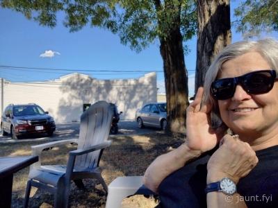
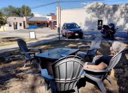
Into the grocery store, where they had a whole wicker basket of $3 sunglasses and whole coolers stocked with orange juice bottles. We grabbed a couple of Adirondack chairs someone had placed under some trees and gradually reinflated over 30 minutes. The navigation software showed we were about 40 miles from the first dispersed camping sites I’d identified. That would take us from Hot Springs to Paradise to Plains—this last location being one the mystery lady spoke highly of as “more substantial than Hot Springs and with a unique charm.”
This was around 3:30 in the afternoon and the heat was starting to break. We reached Plains and identified the grocery store—which we’d need to return to after unloading gear (no room for anything at this point).
We forge ahead another 20 miles, honing in on GPS coordinates I’d manually keyed in from iOverlander to the OSM Android tablet on the handlebars. It’s giving me turn-by-turn directions to a place called the “Muchawater campsite.” From iOverlander I knew there were multiple other campsites along this stretch—and sure enough we started seeing metal signs with lean-to symbols.
By this point in my trip, I’d lost the concern about finding campsites that I’d had near Silverthorne. We had our pick of spots since it was mid-week and Montana emphasizes camping destinations.
The Muchawater site has no picnic tables but sits along a lovely river. The site we pick is maybe 30 feet with a steep descent to the water. Over 2/10 of a mile there are probably four sites and one other camper—who appeared to be sleeping in a hammock strung from his pickup truck door to a nearby tree.
We set up camp quickly, then made a return trip to Plains for groceries and dinner in the downtown park before heading back.
The iOverlander profile warned us about the other feature here—the freight railroad line directly across the river that passes through 3-4 times throughout the night. One reviewer put it well: “There are no intersections nearby so they don’t blow their horn. But the fast-moving rolling stock will wake you up in a not-unpleasant way.”
Just as they’d written, around 11:30 at night the first one rolls through—going left to right. I grin and think how much Aaron would appreciate the hobo aspect of being out here. He’s heard me tell stories of my Grandpa “Corny,” who during the Depression used to hop freight trains to get out West.
So here we are—we had no clue where we’d sleep when we woke up this morning, but managed alright after all. With no camp fee tonight, it’s an easy decision to forego oatmeal and get a good breakfast in St. Regis tomorrow.
Stats
- Highlight :
- Miles :
- Hours :
- Cost :